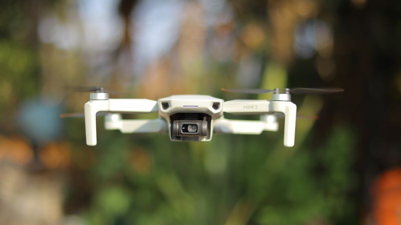
Why Drone Surveys Are Changing the Way Kenya Maps Its Land
A topographic survey that once took weeks on foot can now be completed in a day from the air. Drone photogrammetry is producing orthomosaics and digital elevation models at resolutions traditional methods simply cannot match and at a fraction of the cost. Here is what that means for developers, engineers and county planners working with Kenyan terrain.
The key shift is not just speed it is the quality of the data. A drone survey at 2cm resolution captures detail that changes the accuracy of cut-and-fill calculations, drainage design and infrastructure placement. We have seen projects where better elevation data at the survey stage saved clients significant redesign costs during construction.
Read full article →
What Every Land Buyer in Kenya Should Know Before They Sign
Billions of shillings are lost every year in Kenya's land market not because of outright fraud alone, but because buyers make decisions without enough verified information. They see a title deed, they walk the plot, and they sign. What they often do not check: whether the boundaries match the title, whether the land is in a flood zone, whether the access road is actually accessible in the rains, or whether there are unregistered encumbrances.
The data to answer all of these questions exists. Soil information, terrain models, flood risk layers, satellite imagery and title registry data are all accessible. What has been missing is a fast, clear way to bring it all together for a buyer before they commit. That is exactly what we are building.
Read full article →
How Satellite Imagery Is Quietly Reshaping Infrastructure Planning Across Africa
Ten years ago, getting useful satellite imagery for a project in East Africa meant expensive commercial data purchases and long lead times. Today, Sentinel-2 passes over Kenya every five days at 10-metre resolution for free. Landsat, MODIS, and a growing stack of commercial platforms have made satellite data more accessible than at any point in history.
The organisations using this data well are gaining a real edge. They are siting infrastructure with better terrain and land cover intelligence, monitoring construction progress remotely, detecting encroachment on protected areas, and modelling climate risk across landscapes. The data is there the bottleneck now is the capacity to use it. That is where we come in.
Read full article →